
The University of British Columbia Botanical Garden and the Coastal Douglas-fir Conservation Partnership (CDFCP) are collaborating on a project called Action for Adaptation. The purpose of the project is to develop decision and policy support tools for local governments and First Nations on BC’s south west coast to support actions for climate adaptation and biodiversity conservation. The mapping workshop was delivered as part of this project.

In November 2023 UBC Botanical Gardens, UBC’s Earth Observation and Spatial Ecology Lab and the Coastal Douglas-fir Conservation Partnership (CDFCP) held a Biodiversity Mapping Workshop at the Mary Winspear Centre, Sidney. The workshop was completed to feed into a project called Action for Adaptation. The Project aims to support local governments and First Nations to accelerate climate adaptation and resilience by providing mapping and tools that they have indicated are needed to conserve and restore nature-based solutions (NBS) for climate change.
The goals of the workshop were to;
- share progress on the Biodiversity Atlas and learn how this work could support local governments and First Nation;
- discuss how the pilot mapping layers could connect to decision making that supports biodiversity; and
- support planners and decision makers to strengthen the network of knowledge holders on the south-west coast.
To date, the project team has held in-depth interviews and a workshop in October 2022 with planners, decision makers and mappers, to better understand the needs and priorities of spatial data users, identify gaps and deficiencies, and identify potential collaborations and opportunities for filling them (Figure 3). This work identified the need for the following six mapping layers;
- Land cover and land cover change
- Environmentally Sensitive Areas
- Terrestrial carbon
- Species at risk and/or of cultural value
- Ecosystems connectivity
- Hydrologically sensitive ecosystems
The Biodiversity Mapping Workshop held in November 2023 focused on the mapping layers that are presented in bold. The workshop was structured to share information on local examples of mapping that has been completed / or is ongoing in relation to each of the topic areas; to present pilot options for mapping these layers and to review with attendees, through breakout groups, the challenges and opportunities of the pilot layers. The Sunshine Regional District was the focus area for the pilot layers.
Biodiversity Mapping in Southwest British Columbia 2023 Report
This report presents:
- a summary of the presentations which can be viewed in the videos below;
- recommendations shared by attendees during the discussion groups: and
- next steps for the Biodiversity Atlas.

Presentations
An objective of the workshop was to share information about mapping projects that are being undertaken by others in the project area in relation to; policy and mapping; species at risk and of cultural value; ecosystem connectivity and Environmentally Sensitive Areas (ESAs). Below are the recordings for each of the presentations delivered at the workshop and their associated slide deck.
Context Setting
Tara Moreau (UBC Botanical Gardens) welcomed attendees to the workshop, provided an overview to the Action for Adaptation project and shared details of how UBC Botanical Gardens and the CDFCP entered into a partnership for the project.
Lyndsey Smith (CDFCP) provided an overview of the work that the project had achieved to date and how the project would continue over the next two years.
Connecting Mapping to Policy
Professor Deborah Curran from the University of Victoria’s Environmental Law Centre shared a presentation the role of mapping in a policy context. The presentation covered three topic areas;
- Jurisdiction and UNDRIP
- Connectivity, Systems, Scale
- DPAs for Protection of the Natural Environment
Species at Risk and of Cultural Value
Jessica Lukawiecki, Research Supervisor, Stó:lō Resource and Research Management Centre (SRMC) which is part of the S’ólh Téméxw Stewardship Alliance (STSA) provided an introduction to two projects.
Conservation of Species, Ecosystems and Indigenous Values in S’ólh Téméxw Project (COVIST). The goal of project is to identify priority areas with multiple values such as species, ecosystems and indigenous value (cultural, spiritual or harvesting area). The Species at Risk and Stewardship Project (SRSP) is focused on collaborative planning of conservation activities that protect and restore culturally important species at risk in Stó:lō territory. Goals are to build capacity to take part in conservation and stewardship activities for culturally valuable species including, but not limited to, wolverine, coastal giant salamander, western red painted turtle and grizzly bears.
Mapping Ecological Connectivity in Cities
Aubery Butcher from Diamondhead Consulting provided an introduction to the extensive experience they have gained mapping ecosystems connectivity on behalf of local and regional governments on the south-west coast of BC. The presentation highlights how the approach to mapping differs depending on the scale the mapping is being completed at.
Environmentally Sensitive Areas Mapping in the City of Courtenay
Appendix A
CDFCP Nature Smart Project, UBC Botanical Gardens Climate Adaptation Project and the Biodiversity Atlas Project
These three documents provide an overview of the work being undertaken by the CDFCP Nature Smart Project funded by the federal government, the UBC Botanical Botanical Gardens Climate Adaptation Project which is funded by a private donor and demonstrate the mutual objectives of the two projects.
Appendix B - Pilot Maps -Sunshine Coast Regional District
The mapping below was developed to initiate discussion at the workshop. The mapping should not be considered a final/verified product as the methodologies used are currently being reviewed by a independent consultant and the mapping will be updated following consultation.
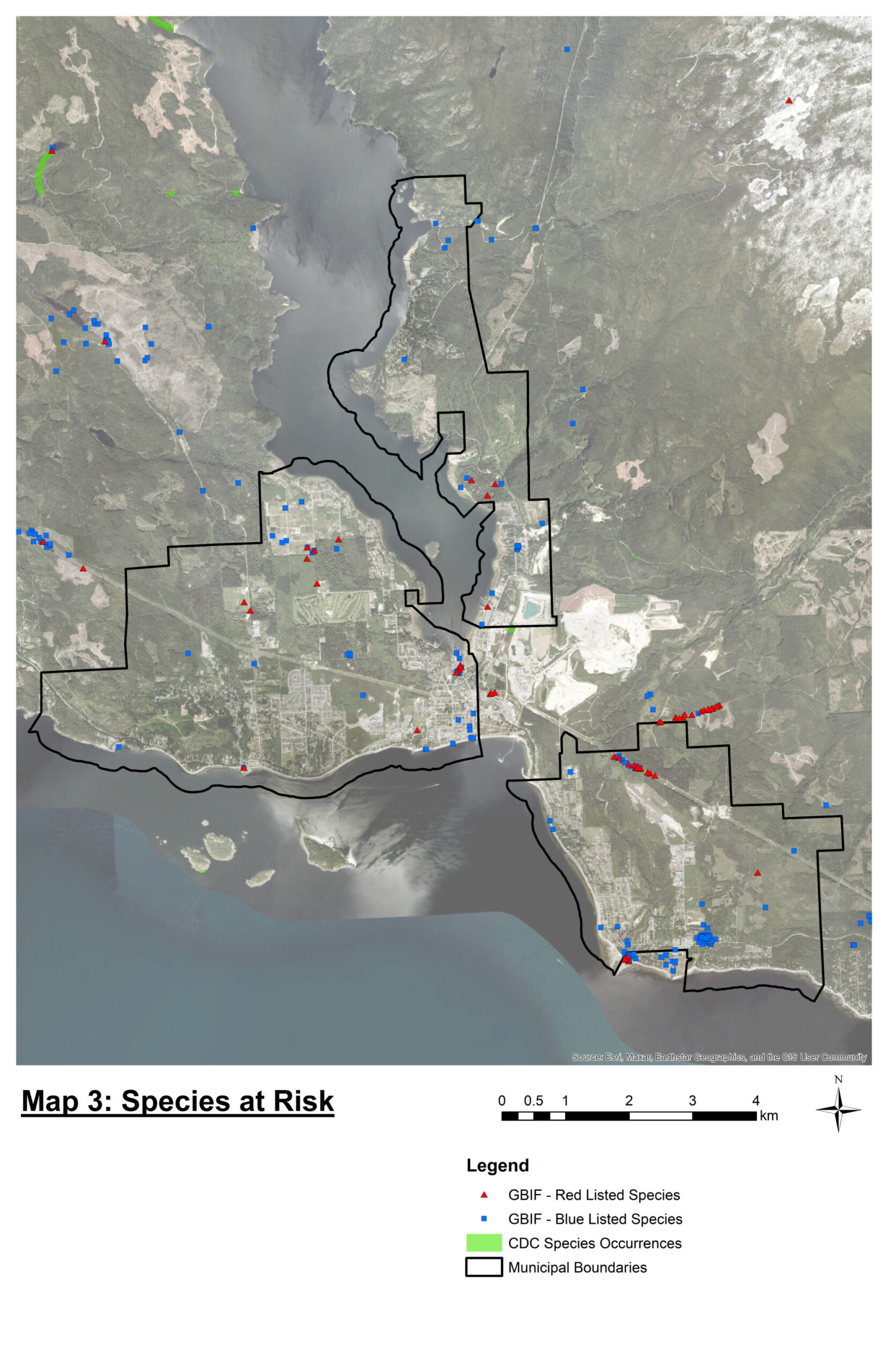
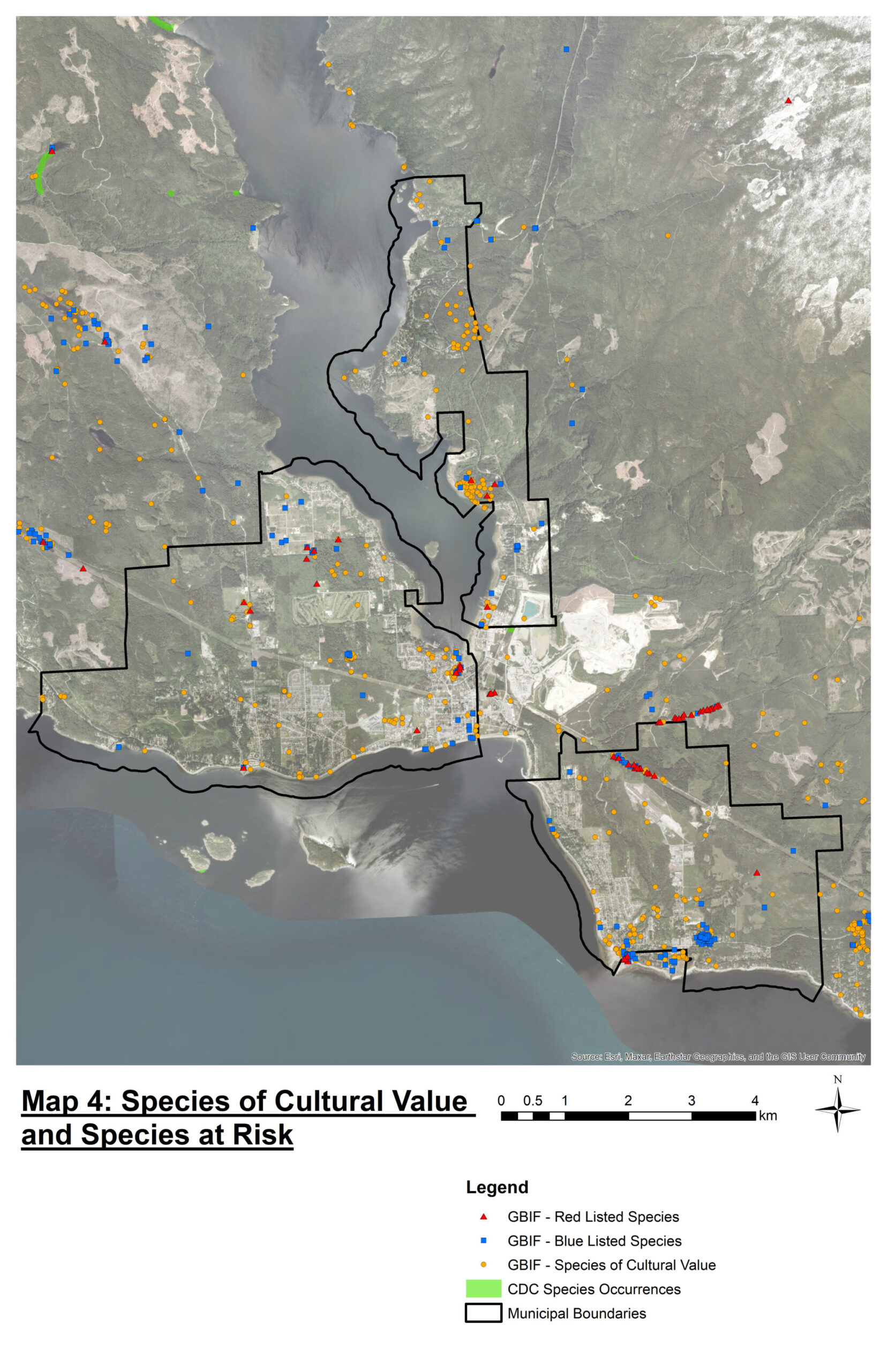
Species at Risk and Cultural Value Mapping
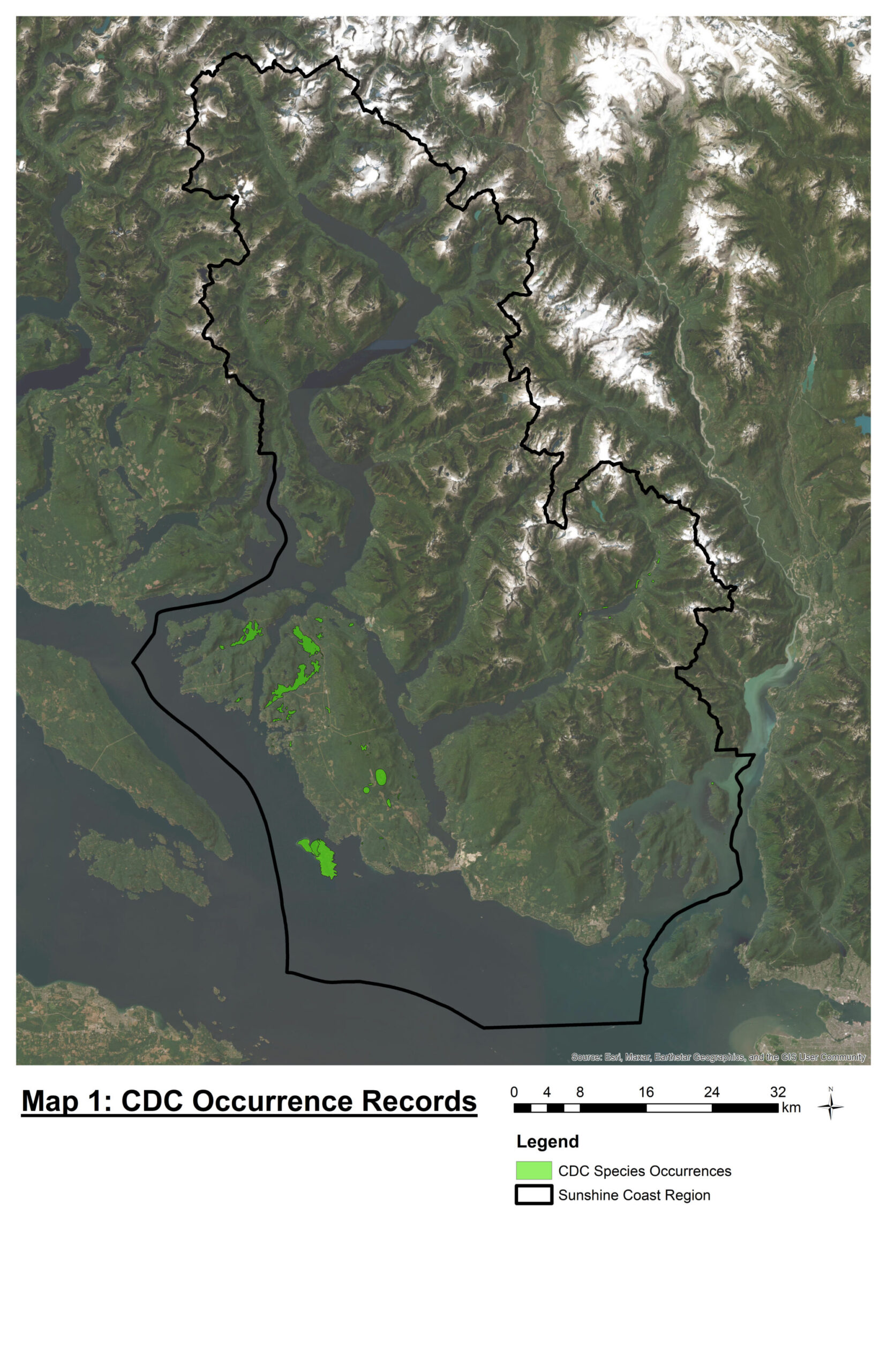
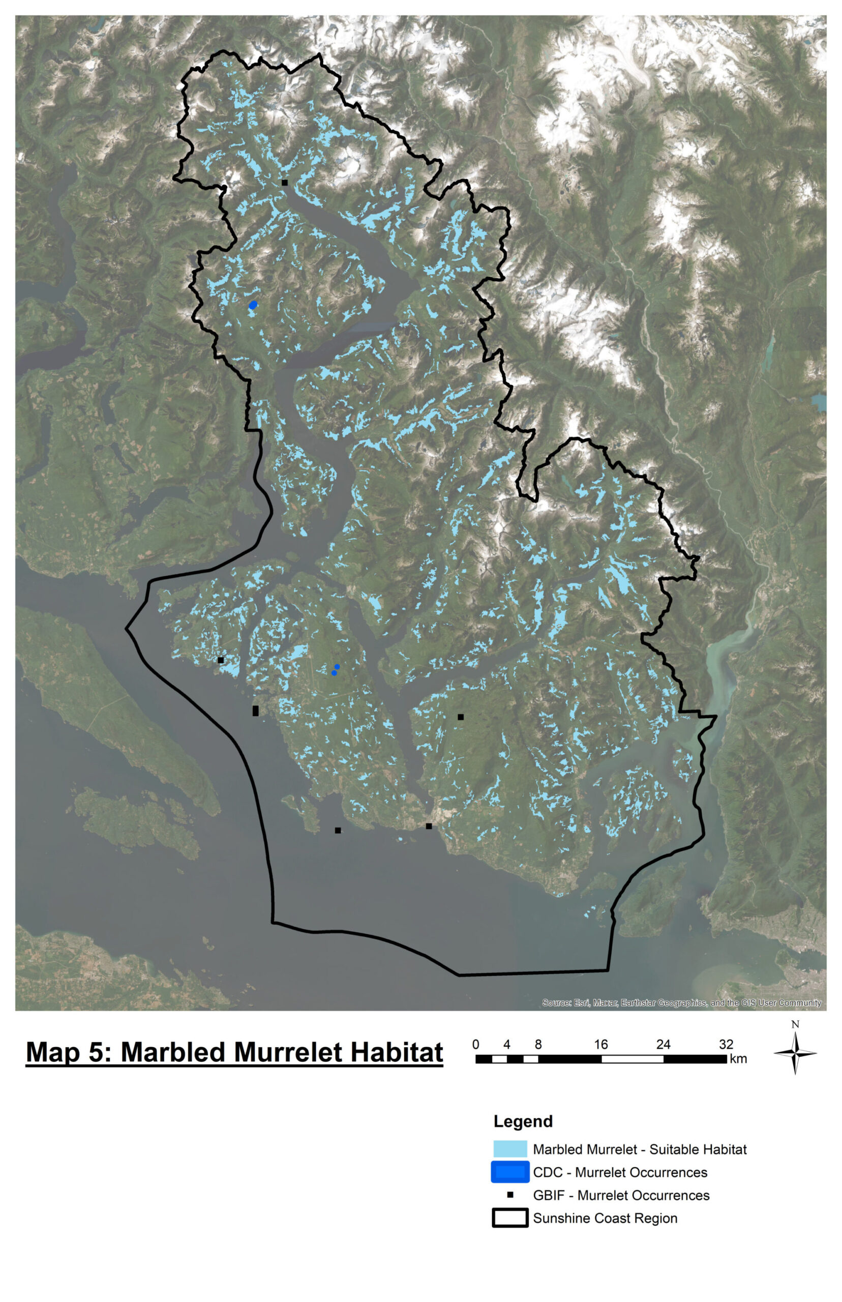
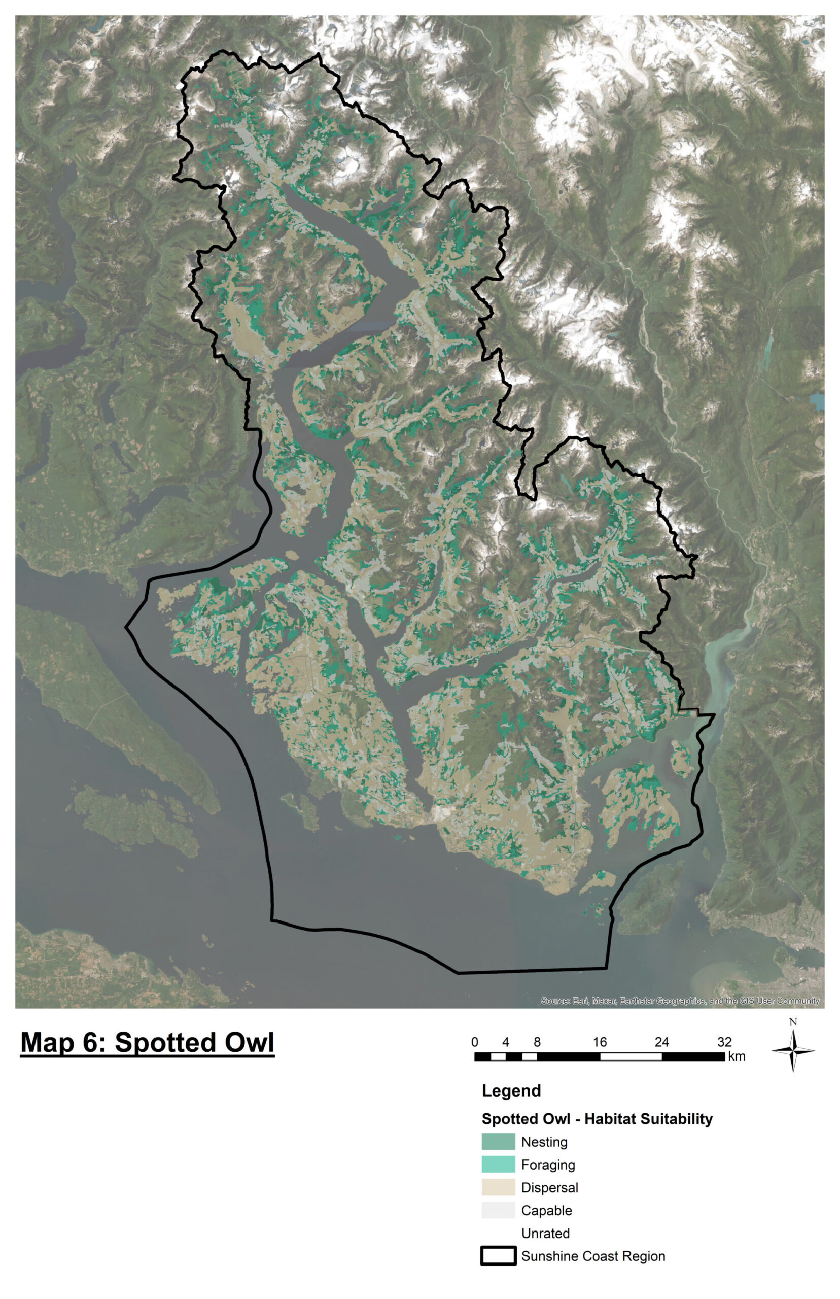
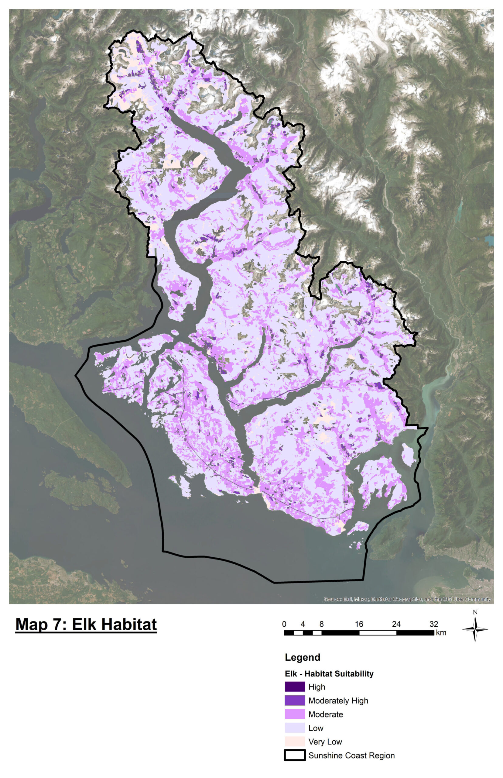
The pilot maps were prepared Erin Crockett, Earth Observation and Spatial Ecology lab, UBC Okanagan. The maps demonstrate that species records have bias towards where people live; species that are active during the day and charismatic species. The maps show that citizen science can fill gaps in information. A pilot map was produced of culturally valuable species that have been taken from published literature. The purpose of this presentation was to illustrate that valued species go beyond species at risk.
Map 1 – Conservation Data Centre (CDC) Species at Risk Records .
Map 5, 6 & 7 – Habitat suitability maps for marbled murrelet; spotted owl and spring foraging for elk.
Ecosystem Connectivity
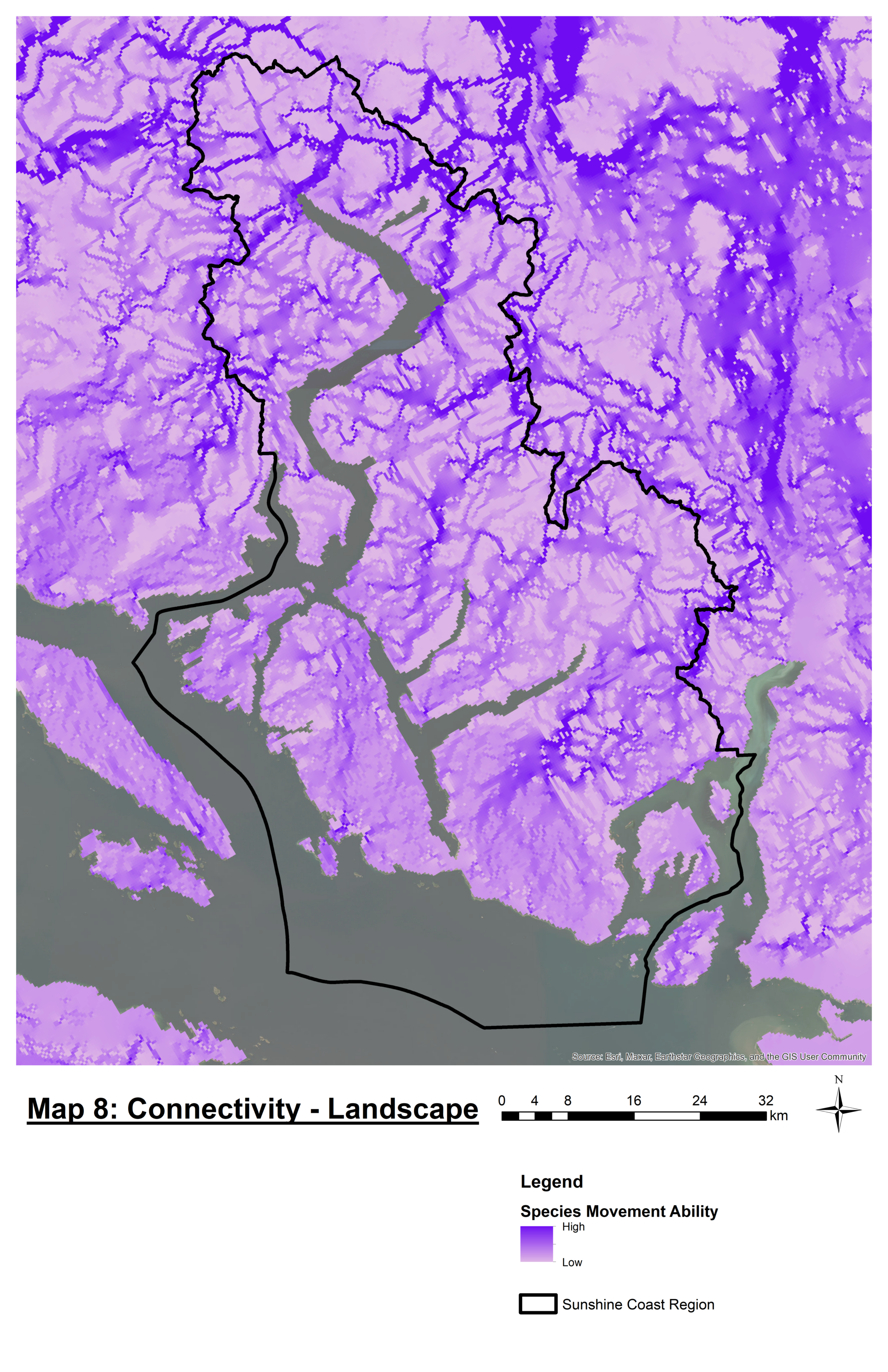
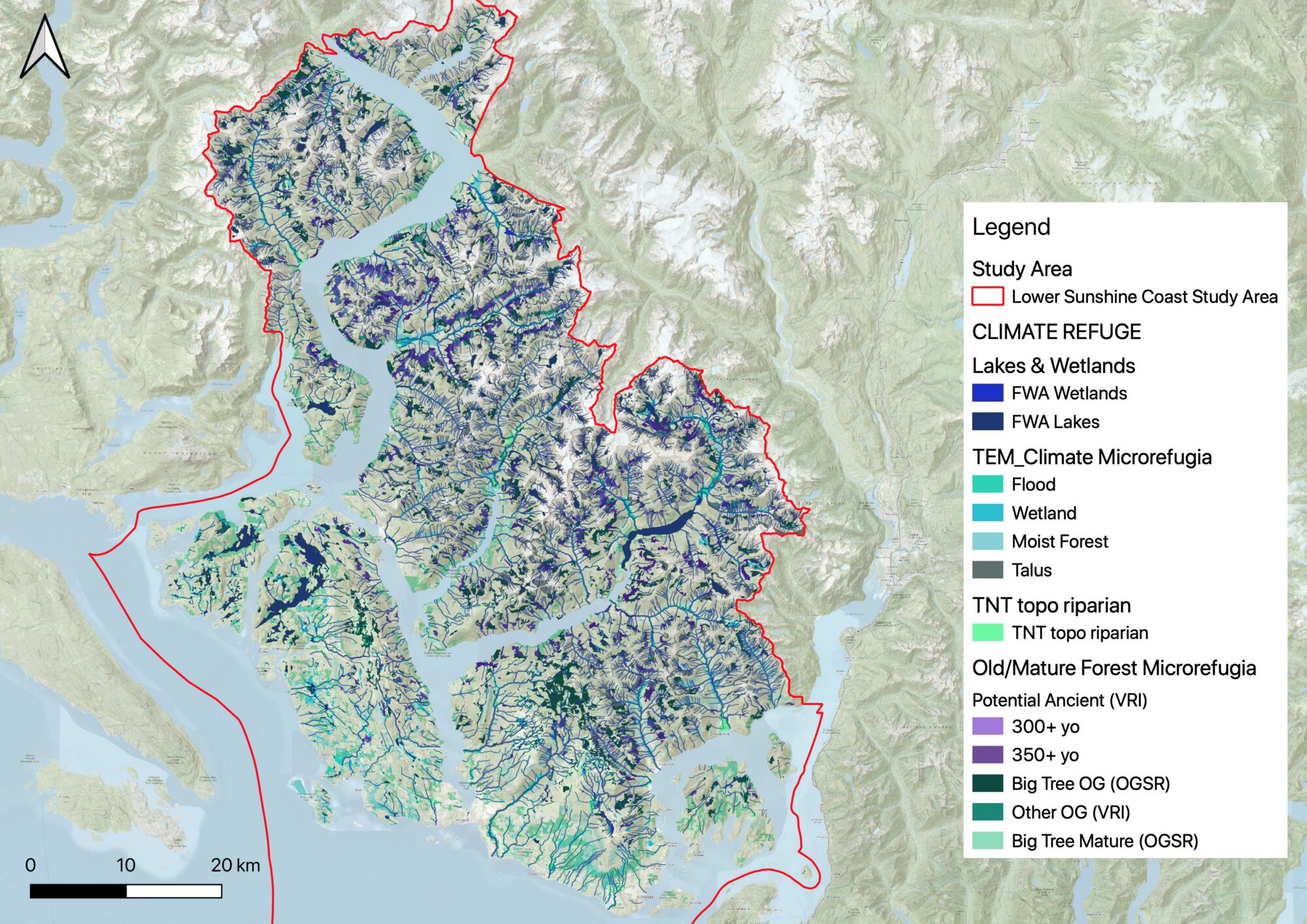
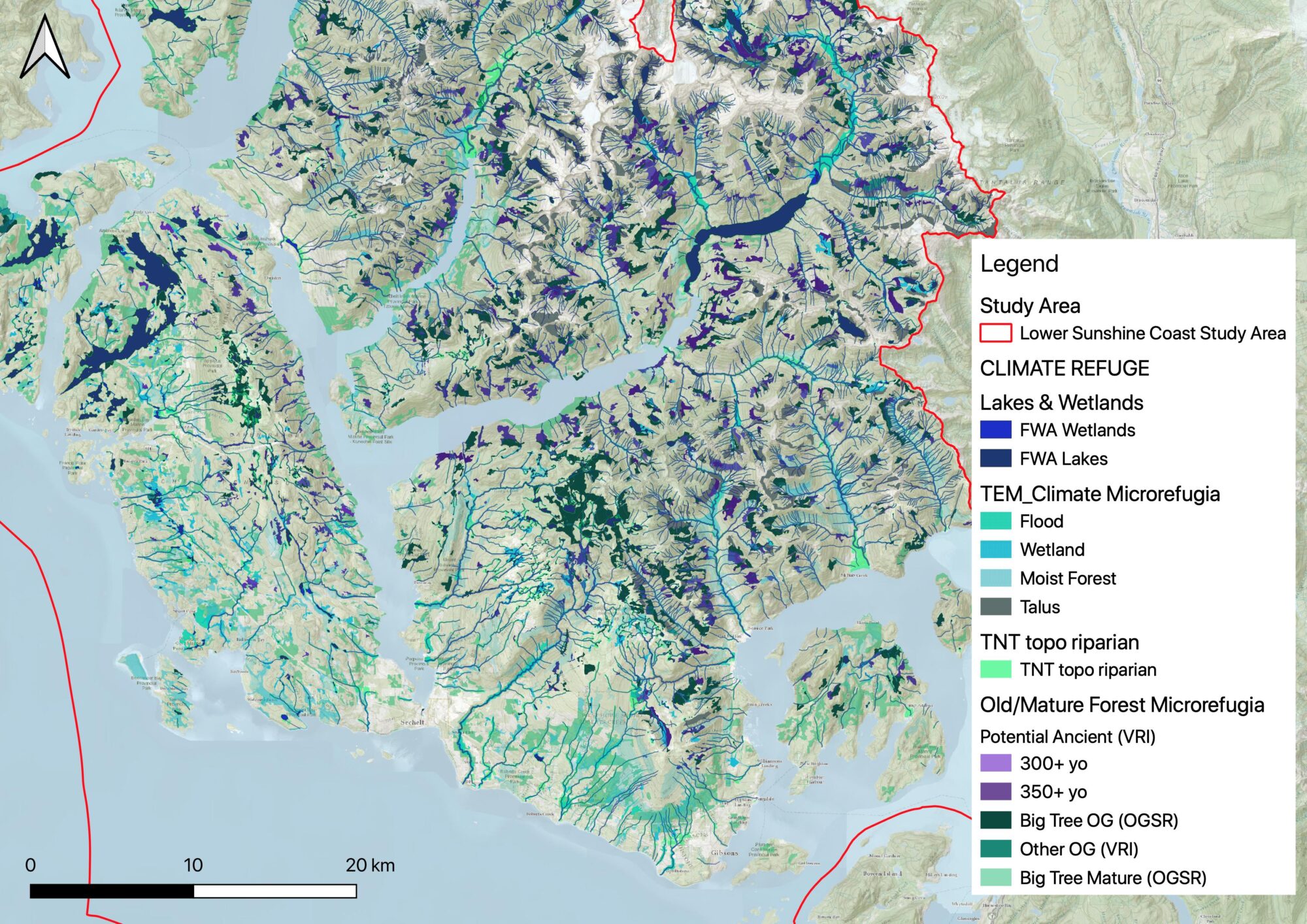
Kelly Chapman presented pilot work that she had undertaken with Allison Haney to identify habitats on the landscape that could provide climate refugia for species as summer temperatures increase and the ecosystems are subjected to prolonged periods of drought.
Map 8 – National connectivity mapping produced by Pither et al (2023), which uses circuit theory to identify ecosystems that are likely to facilitate species movements. The research identified that this approach was effective for predicting corridors for large mammal species but not for amphibians. In the Sunshine Coast Regional District some of the corridors run along the mountain ridges. This is not the location of the old productive forests, known to support species at risk, which are typically located by the coast in the stream valleys. Therefore, not potentially appropriate for local level planning.
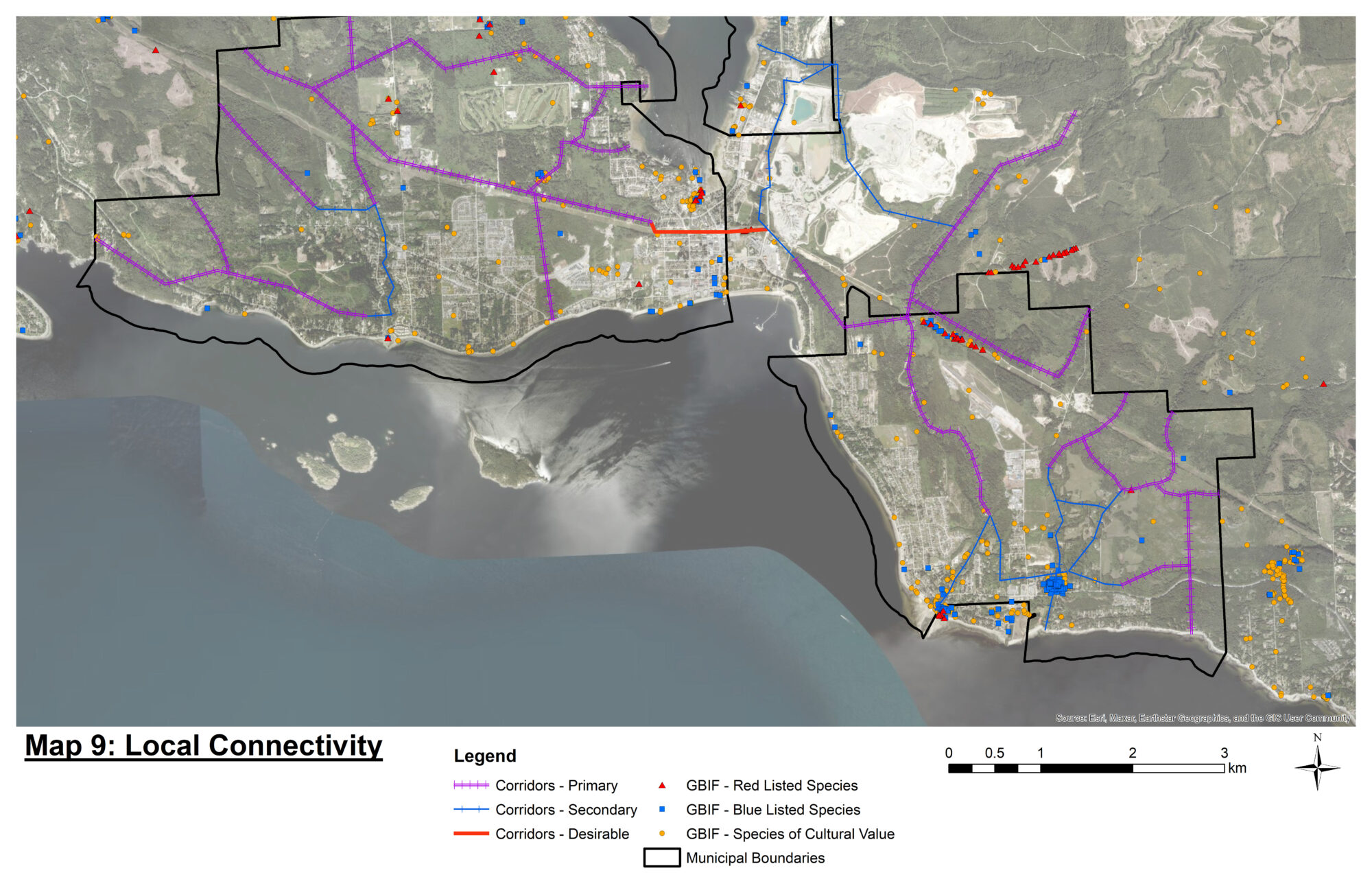
Map 9 – Structural Ecosystem Connectivity mapping in the District of Sechelt. This provides a simplified approach to connectivity mapping presenting primary and secondary connectivity and opportunities to restore connectivity.
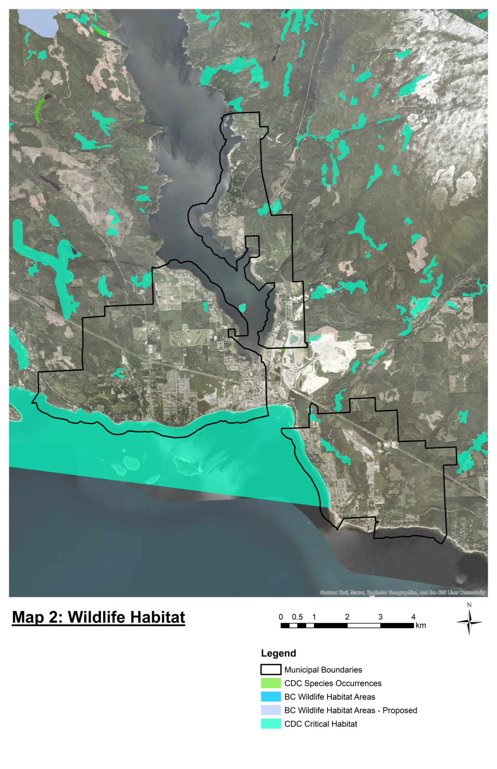
Environmentally Sensitive Areas (ESAs)
Kelly Chapman presented pilot maps that she had produced with Allison Haney to identify ecosystems at risk and sensitive ecosystems by mining information from the Terrestrial Ecosystem Mapping (TEM); Vegetation Resource Inventory (VRI); Old Growth Strategy Review layers and the Species and Ecosystem Explorer.
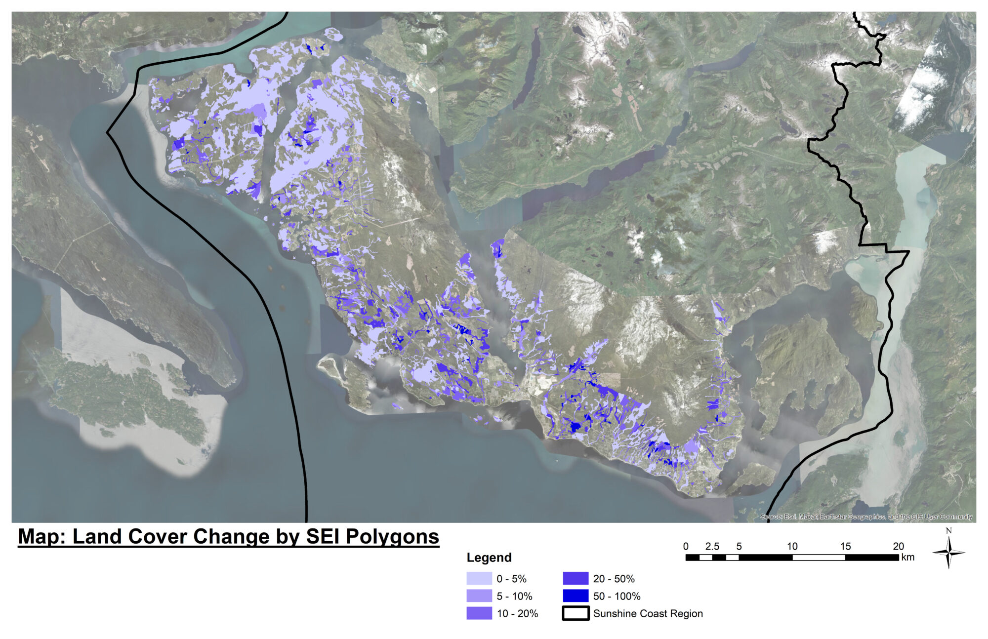
Erin Crockett Postdoctoral Fellow at UBC Okanagan Earth Observation and Spatial Ecology Lab provides overview of how the Sensitive Ecosystem Inventory polygons have changed since they were mapped in the 1990’s and how LiDAR could be used to help monitor change in the landscape.
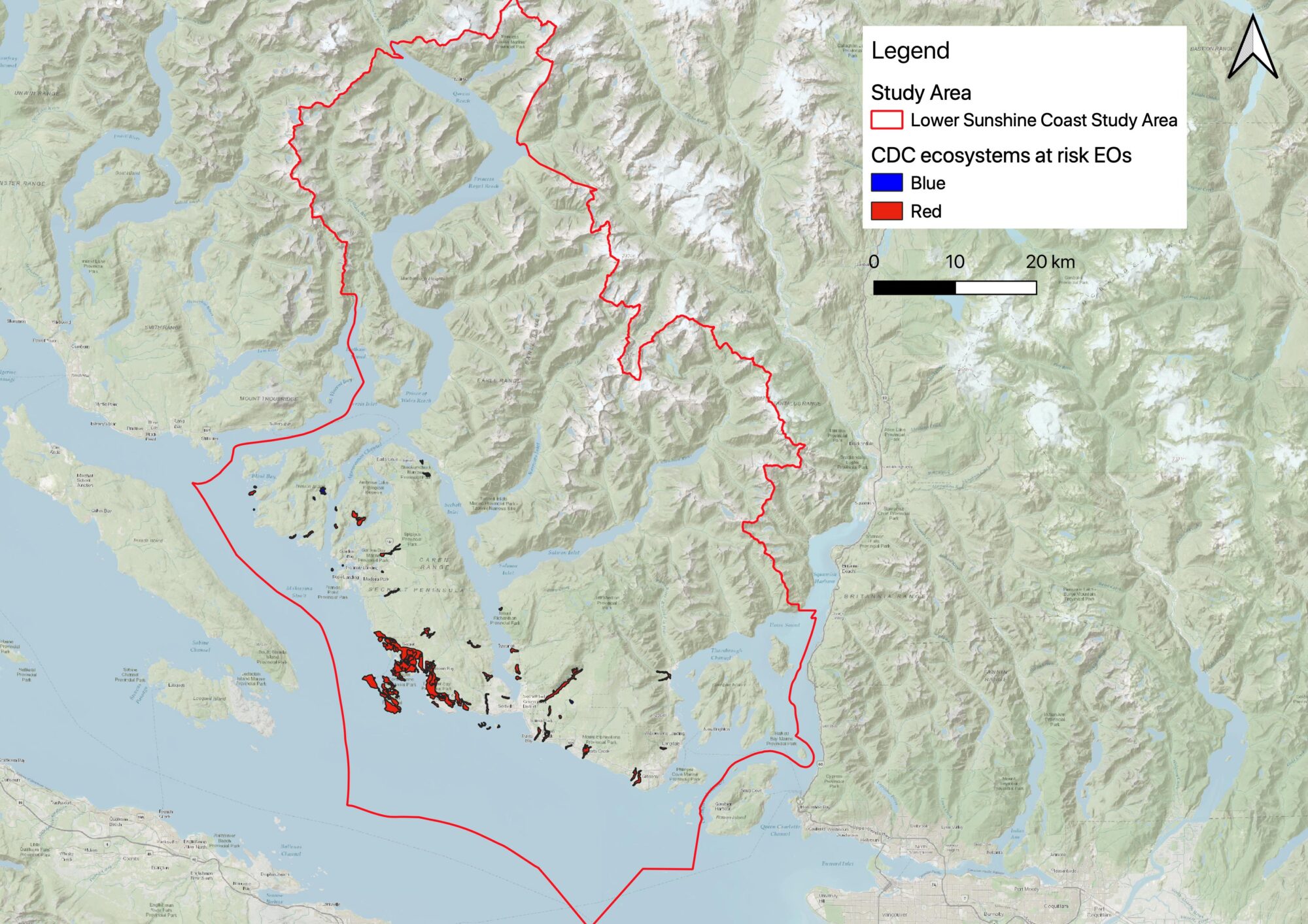
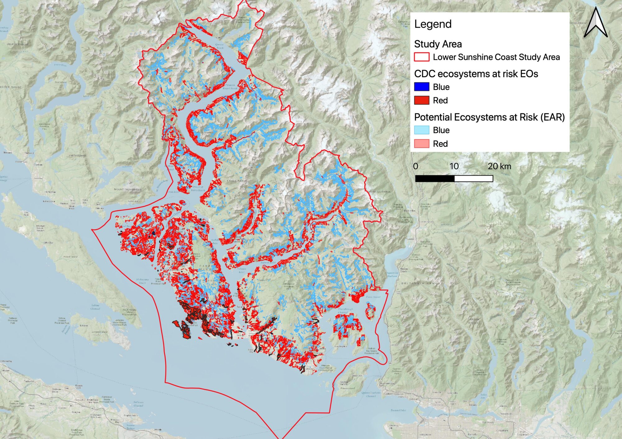
Map 11 – Ecosystems at Risk mapped by the Conservation Data Centre (CDC). The coverage is limited as they have only reviewed the TEM within the CDFmm. They have also only extracted information on 13 of the 45 ecosystems at risk known to be present in the local area.
Map 12 – Ecosystems at Risk extracted from TEM in the CDFmm and beyond.
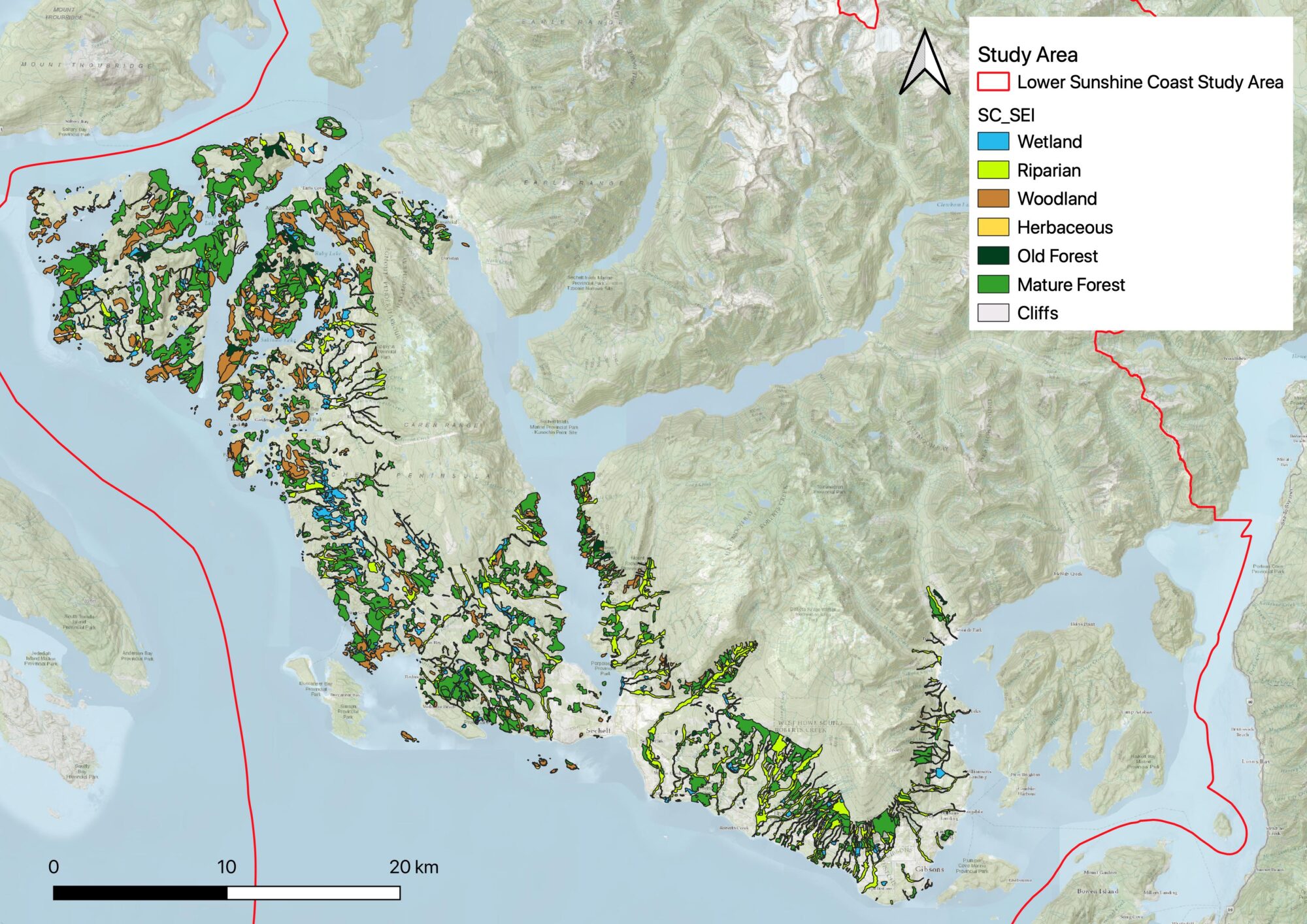
Map 13 – Sensitive Ecosystem Inventory (SEI) mapping completed in 2005 focused in the CDFmm.
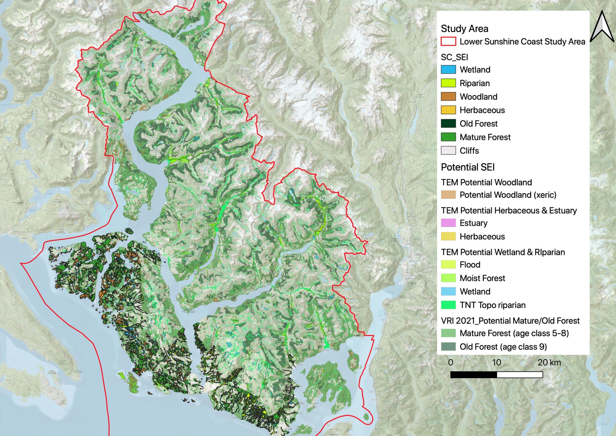
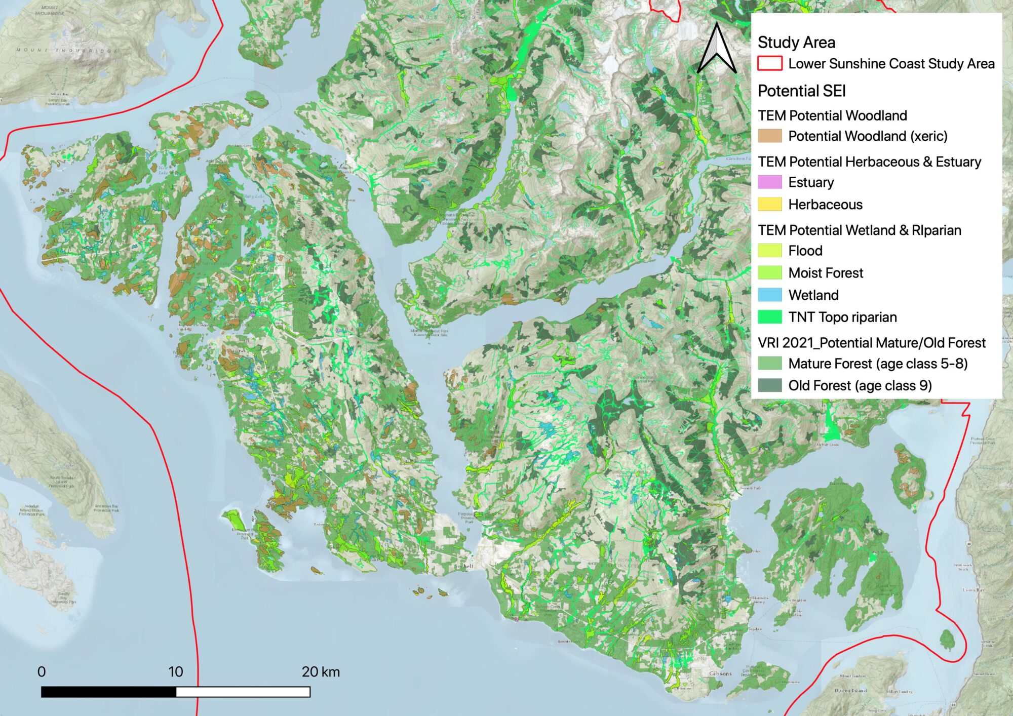
Map 15 – Illustrates the amount of change in the mapped areas of SEI since 2005.
The workshop was funded by;

